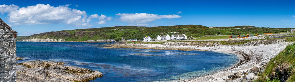
Where is Rathlin Island? Location, Maps and How to Get There
Rathlin Island sits in the North Channel, the stretch of water that separates the north-east coast of Ireland from the south-west coast of Scotland. It lies approximately six miles north of Ballycastle in County Antrim, Northern Ireland, and around fifteen miles south-west of the Mull of Kintyre on the Scottish mainland.
It is, in short, an island caught between two countries. Close enough to Ireland to belong to it, close enough to Scotland to have spent centuries being argued over. On a clear day you can see both coastlines from Rathlin at the same time, which gives the island a genuinely unique sense of place that is unlike anywhere else in the British Isles.
The Basics
Rathlin Island is the most northerly inhabited island off the coast of Ireland and Northern Ireland’s only permanently inhabited offshore island. Around 150 people live there year round, making it one of the smallest island communities in the British Isles.
The island itself is L-shaped, roughly four miles from east to west and two and a half miles from north to south at its widest points. Its highest point is Slieveard, which rises to 134 metres above sea level. Three lighthouses mark its coastline — take a look at our guide to the lighthouses of Rathlin Island to find out what makes each one special.
The nearest town on the mainland is Ballycastle, a small harbour town on the north Antrim coast and the starting point for every trip to the island. Our guide to Ballycastle covers everything you need to know about the town before you make the crossing.
Where Exactly is Rathlin Island on a Map?
If you are looking at a map of Ireland, find the north-east corner of the island and look for the town of Ballycastle on the coast. Rathlin sits directly north of Ballycastle, clearly visible as a small L-shaped landmass just off the coast. The coordinates for the island’s main settlement, Church Bay, are approximately 55.3 degrees north, 6.2 degrees west.
Rathlin sits at a similar latitude to parts of southern Scotland and is further north than most of the British Isles outside of Scotland itself. This northerly position is part of what gives the island its dramatic light and its sometimes unpredictable Atlantic weather.
How Do You Get to Rathlin Island?
The only way to reach Rathlin Island is by ferry from Ballycastle Harbour. The crossing takes around 45 minutes and the service runs several times daily during the visitor season, with reduced crossings in winter. Booking in advance is strongly recommended in summer, as the Rathlin Island ferry fills up quickly during the peak puffin watching season between May and July.
There is no car ferry for general visitors. You park in Ballycastle and travel as a foot passenger. Once on the island you can walk, hire a bicycle from the harbour or take the Puffin Bus, a seasonal minibus that runs between Church Bay and the RSPB West Light Seabird Centre. For full details on timetables and what to expect on the crossing, take a look at our complete guide to getting to Rathlin Island.
Why is Rathlin Island Worth Visiting?
People visit Rathlin Island for many different reasons. The island is home to Northern Ireland’s largest seabird colony, and between late April and August thousands of Atlantic puffins on Rathlin Island nest on its western cliffs. The RSPB West Light Seabird Centre sits above those cliffs and provides what is genuinely one of the finest wildlife experiences on Rathlin Island in the British Isles.
Beyond the puffins, Rathlin has over 7,000 years of human history. It was the site of Ireland’s first Viking raid in 795 AD. Robert the Bruce hid in a cave on its eastern cliffs in 1306, where the famous spider legend is said to have taken place. In 1575 it was the scene of the MacDonnell Massacre, one of the darkest episodes of the Elizabethan conquest of Ulster.
The island also has some outstanding coastal walking trails, three remarkable lighthouses, over 40 shipwrecks in its surrounding waters, and a community pub that serves a very good pint.
A Note on its Unusual Position
Rathlin’s position between Ireland and Scotland is not just a geographical curiosity. It shaped the island’s entire history, from the Viking raids of the ninth century through to the formal dispute over ownership that was settled in 1617 by releasing a snake on the island — you can read the full story in our article about the Snake Test of 1617.
That combination of wild natural beauty, ancient history and genuine remoteness is what makes Rathlin Island so compelling. It is six miles from the mainland and, in almost every way that matters, a world away. When you are ready to start planning, our complete Rathlin Island visitor guide has everything you need.